Exporting GeoTIFF files using Mapping Toolbox in R2011a
This is my first post using R2011a, which shipped last week. (MathWorks ships product-line updates twice per year, usually in March and September.) There's a lot of interesting material to write about for this new release.
Because my blog readers have been asking for it for a long time, the first thing I want to mention is the new Mapping Toolbox function geotiffwrite.
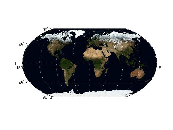
Here are a couple of examples from the documentation. The first example reads a layer from a NASA WMS (Web Map Service) server and writes it out to a GeoTIFF file.
nasa = wmsfind('nasa', 'SearchField', 'serverurl');
layerName = 'bluemarbleng';
layer = nasa.refine(layerName,  'SearchField', 'layername', ...
  'MatchType', 'exact');
[A, R] = wmsread(layer(1));
filename = [layerName '.tif'];
geotiffwrite(filename, A, R)
worldmap world
geoshow(filename)

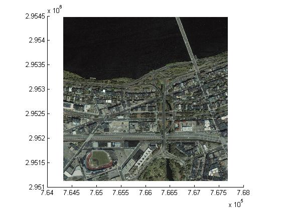
The next example reads an image from an existing GeoTIFF file, and then it writes out the first 1024 columns and last 1024 rows to a new GeoTIFF file.
[A, R] = geotiffread('boston.tif');
row = [size(A,1)-1024+1 size(A,1)];
col = [1 1024];
subImage = A(row(1):row(2), col(1):col(2), :);
xi = col + [-.5 .5];
yi = row + [-.5 .5];
[xlim, ylim] = intrinsicToWorld(R, xi, yi);
subR = R;
subR.RasterSize = size(subImage);
subR.XLimWorld = sort(xlim);
subR.YLimWorld = sort(ylim);
info = geotiffinfo('boston.tif');
filename = 'boston_subimage.tif';
geotiffwrite(filename, subImage, subR,  ...
    'GeoKeyDirectoryTag', info.GeoTIFFTags.GeoKeyDirectoryTag);
mapshow(filename);

If you'd like to know more about the capabilities of this new function, I encourage you to take a look at the extensive new example online.
Stay tuned for more about R2011a...


コメント
コメントを残すには、ここ をクリックして MathWorks アカウントにサインインするか新しい MathWorks アカウントを作成します。